Logan City, Arizona records
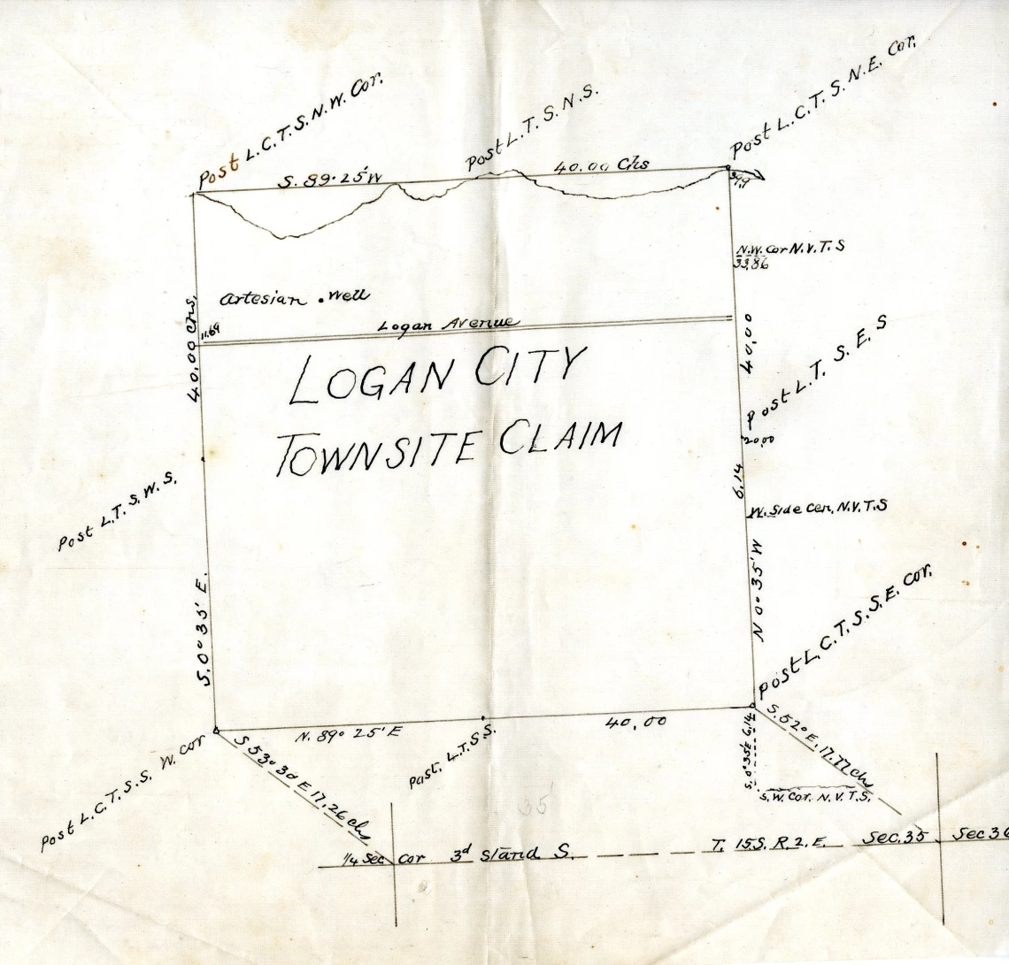
Logan City Townsite Claim map, with details such as the well, and Logan Avenue
Collection area: Arizona and Southwest
Collection dates: 1883-1887
The collection includes several letters to George Roskruge from John [Logan], William R. Logan and R. B. Elliot, clerk of the company, pertaining to his survey work and other interests in Logan City. Also present are notice of location papers for the Black Bird Mine; correspondence relating to a conflict of interest involving John Gardiner, Deputy Mineral Surveyor; and correspondence and legal documents concerning a dispute, between James M. Quiggle and the Logan Townsite and Well Company, over financing of the town well.
Blueprint and pencil maps include individual maps of coordinates for each townsite claim for Logan City, New Virginia City, and Brooklyn which were adjacent townsites; maps of mining claims of the Quijotoa Mining District; and a plat map of town lots in Logan City.
Logan City, Arizona, was located in Pima County, 65 miles west of Tucson. It was established in 1883 following the discovery of silver ore in the Quijotoa Mining District. Soon there were more than 1,200 inhabitants and over 200 houses. By 1886, the mining boom ended and most residents moved on.
The town was named for John T. Logan and William R. Logan; two of the partners of the Logan Townsite and Well Company. Other partners included James H. Shotwell and George J. Roskruge. Roskruge was county surveyor and was responsible for surveying the town.
A collection guide explains what's in a collection. New to using our collections? Learn how to use a collection guide.
Collection guideAccess this collection
Visit us in person to access materials from this collection. Our materials are one-of-a-kind and require special care, so they can’t be checked out or taken home.
How to cite
Learn how to cite and use materials from Special Collections in your research.